The Picard Maneuver@piefed.world to Just Post@lemmy.worldEnglish · 24 days agoAnd then just going about your daymedia.piefed.worldimagemessage-square126linkfedilinkarrow-up1538arrow-down116
arrow-up1522arrow-down1imageAnd then just going about your daymedia.piefed.worldThe Picard Maneuver@piefed.world to Just Post@lemmy.worldEnglish · 24 days agomessage-square126linkfedilink
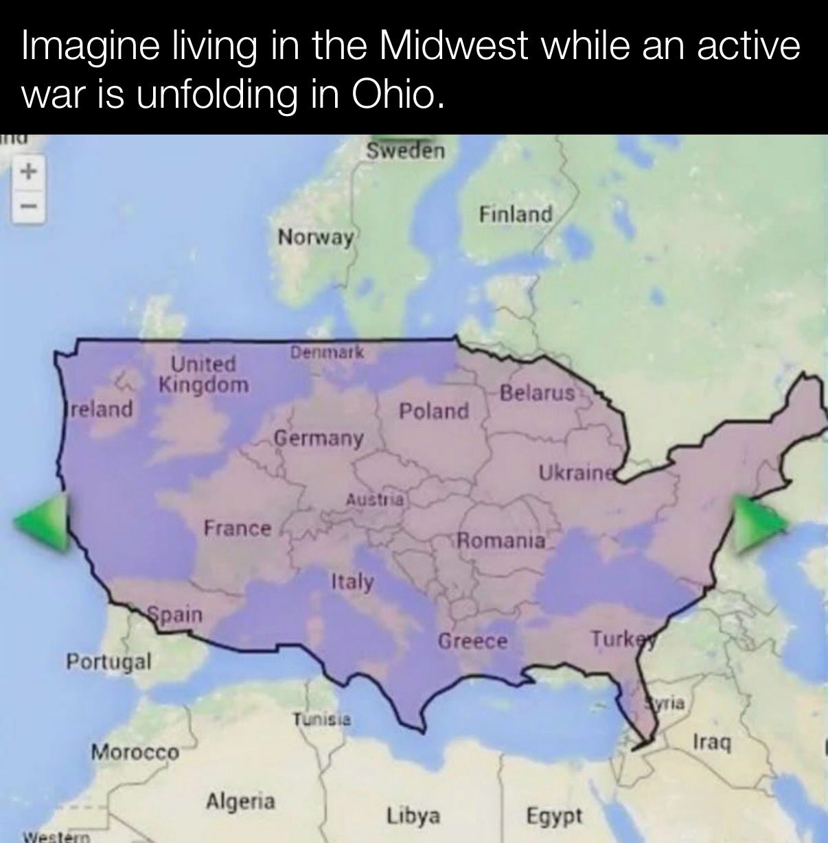
minus-squareCaptain Aggravated@sh.itjust.workslinkfedilinkEnglisharrow-up2·24 days agoGiven how the US border is distorted (Maine is north of the 49th parallel) I’m guessing this is one of those maps that distorts things as you move them around to keep the area constant. Like look how big Greenland looks up in the corner.
minus-squareCaptain Aggravated@sh.itjust.workslinkfedilinkEnglisharrow-up2·24 days agoThen what is the unlabeled landmass at the very top left, northeast of Iceland?
minus-squareAtomic@sh.itjust.workslinkfedilinkarrow-up2·edit-224 days ago The landmass in the very top left on the image in this post. Is Iceland. Greenland is not northeast of Iceland either. It’s northwest.
minus-squareCaptain Aggravated@sh.itjust.workslinkfedilinkEnglisharrow-up1·23 days ago I meant this one, from earlier in this thread.


Given how the US border is distorted (Maine is north of the 49th parallel) I’m guessing this is one of those maps that distorts things as you move them around to keep the area constant. Like look how big Greenland looks up in the corner.
Greenland is not in the image
Then what is the unlabeled landmass at the very top left, northeast of Iceland?
The landmass in the very top left on the image in this post. Is Iceland.
Greenland is not northeast of Iceland either. It’s northwest.
I meant this one, from earlier in this thread.
Right. Sorry, my bad.